|
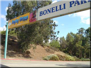
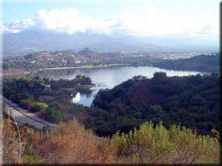
 Begin by exiting the car parking area and turning left onto Via Verde. Immediately after crossing over the 57 freeway you will enter the park. Ride past the toll booth up to a gap in the wooden fence on the right (0.44 miles) at a sign indicating the mounted police training facility. Take the access road on the right, passing to the left of the paddock area. At 0.58 miles this road intersects with a similar path - go right. This soon takes you back to the paved road used to enter the park but rather than crossing it you enter a small tunnel at 0.75 miles to pass underneath. After a fun dip and short climb at 0.88 miles the path crosses a disused paved road - continue straight on the single track until at 0.94 miles you take a sharp left onto a partially paved road. At the 1 mile point continue straight on the Upper Bee Hive trail. One of the best views of the reservoir appears on the right at 1.13 miles. Begin by exiting the car parking area and turning left onto Via Verde. Immediately after crossing over the 57 freeway you will enter the park. Ride past the toll booth up to a gap in the wooden fence on the right (0.44 miles) at a sign indicating the mounted police training facility. Take the access road on the right, passing to the left of the paddock area. At 0.58 miles this road intersects with a similar path - go right. This soon takes you back to the paved road used to enter the park but rather than crossing it you enter a small tunnel at 0.75 miles to pass underneath. After a fun dip and short climb at 0.88 miles the path crosses a disused paved road - continue straight on the single track until at 0.94 miles you take a sharp left onto a partially paved road. At the 1 mile point continue straight on the Upper Bee Hive trail. One of the best views of the reservoir appears on the right at 1.13 miles.
As you descend on the typically well graded fire road, keep left at 1.57 miles. At 1.90 miles you will cross a small wooden bridge (sign posted Walnut trail). The fire road forks at 2.4 miles - go right. At 2.63 miles go right onto the connecting fire road, and left at 2.72 miles.
 A short but fairly steep single track section begins by going right at 2.76 miles - the switchbacks can be cleared without dabbing but it takes some balance and determination. A short but fairly steep single track section begins by going right at 2.76 miles - the switchbacks can be cleared without dabbing but it takes some balance and determination.
2.93 miles sees us back on paved road briefly; at 2.99 miles take Bonelli Trail fireroad on the left. At 3.06 miles go left onto the single track. Bear left at 3.25 miles, crossing a small drainage gully to reconnect with the path and a steel bridge at 3.26 miles, passing by an abandoned pumping station on the right at 3.27 miles.
To climb back to the paved road take the fireroad on the right at 3.31 miles, or the parallel singletrack (steep) at 3.33 miles. Upon reaching the paved road at 3.43 miles go left, followed by a right at 3.45 miles through a gap in the chain linked fence.
3.59 miles has yet another junction - go sharp left. This is a pleasant single track, punctuated with paved parking entrances to cross at 3.81, 4.02 and 4.31 miles. At 4.77 miles go right onto the paved road access road, and then left at 4.8 miles onto a dirt road marked as authorised vehicles only.
 Take the inflow trail at 4.99 miles and at 5.03 miles cross the shallow stream (runs year round). This next section is quite unique as the path is shaded by dense bamboo on both sides, which in combination with the typically muddy surface almost makes it feel like you’re in Hawaii! After a short climb the trail exits onto a paved road alongside Brackett airfield. Take the inflow trail at 4.99 miles and at 5.03 miles cross the shallow stream (runs year round). This next section is quite unique as the path is shaded by dense bamboo on both sides, which in combination with the typically muddy surface almost makes it feel like you’re in Hawaii! After a short climb the trail exits onto a paved road alongside Brackett airfield.
At mile 5.56 leave the paved road by taking the path on the right, joining the Corkscrew trail (to the right) at 5.77 miles. At 5.92 miles go left to take a short cut path to a parallel single track, turning right at 5.95 miles. This is quite a technical single track climb, that may see you walking a little. Note, you can reach the same point by continue to climb the Corkscrew trail, but it’s a tougher climb. At 6.29 miles continue straight on the Cosby Trail, and at 6.33 miles stay left (small restroom building to your right).
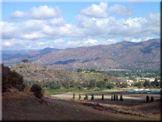
 A single track takes off to the right at 6.64 miles, continue beyond this to the underpass at 6.66 miles and go under the road. Join Coyote trail (on the left) at 6.88 miles, keeping left where the road forks at 6.91 miles. At 7.54 miles bear right. This is the toughest climb of the ride, that will probably see you exercising the granny gear. The 10/57/71 freeway junction will be clearly visible at 7.97 miles. A single track takes off to the right at 6.64 miles, continue beyond this to the underpass at 6.66 miles and go under the road. Join Coyote trail (on the left) at 6.88 miles, keeping left where the road forks at 6.91 miles. At 7.54 miles bear right. This is the toughest climb of the ride, that will probably see you exercising the granny gear. The 10/57/71 freeway junction will be clearly visible at 7.97 miles.
Continue straight at 8.53 miles (Reservoir trail joins from the right), and go left at 8.80 miles. Go left at 9.30 miles, and right at 9.58 miles (towards the park entrance road). Finally at 9.60 miles turn left on the paved road for the short return to the parking area.
|

