3.27 miles: view of first bridge and snow capped mountains ahead
4.89 miles: Need to pass around/under locked gate to continue climb
5.13 miles: entrance to Coldbrook Campground (not used while highway is closed)
6.0 miles: Looking back - road has changed from fast sweeping curves to sharp switchbacks
6.0 miles: view into canyon (first bridge in distance)
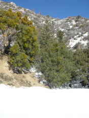
6.0 miles
6.12 miles
6.87 miles: looking back at portion of road that was completely blocked by landslide a few years ago. Road never has never reopened to general access since this was repaired.
6.87 miles: view of climb ahead (can see road at multiple levels)
7.83 miles: view into canyon
7.8 miles
8.16 miles: cabin on left
Stream just beyond cabin
8.41 miles: approaching snowline
9.41 miles: another view into canyon showing road snaking up the mountain side
9.41 miles: start of tough climb
9.41 miles
9.43 miles
10.26 miles
10.52 miles
10.52 miles: sign ahead announces having reached 5000 feet altitude
10.61 miles
10.7 miles
10.82 miles: turnoff on right to Crystal Lake recreation area
11.82 miles: looking back
11.82 miles: looking ahead
12.01 miles: no evidence of visitors other than the snowplow
12.01 miles
12.14 miles: not even animal tracks in the snow
12.14 miles
12.6 miles: approaching the turnaround point
12.6 miles: gate post marks end of public road (gate is closed when highway 39 is open to Crystal Lake)
12.61 miles: even the snowplow doesn't go beyond here. Per GPS the elevation here was 5550'
12.71 miles: beginning the return
Tarantula found wandering along at side of road
Tarantula found wandering along at side of road - possibly suffering a hang-over!
Turn-off to Crystal Lake campground
Small stream on road to Crystal Lake campground
nonchalent deer on road to Crystal Lake campground
General store (closed) and residence at Crystal Lake campground
Site Last Modified: Tuesday, March 10, 2009


")

")


")


")


 and residence at Crystal Lake campground")