Wildflowers
1.77 miles: View looking towards downtown LA
1.77 miles: Downtown LA
1.77 miles: JPL on the right, Verdugo’s beyond and ocean in the distance
2.66 miles: Downtown LA, with ocean beyond
2.71 miles: View towards Echo Mountain and White City (hotel ruins)
2.88 miles: Sunset Ridge trail joining on the left (technical single track)
2.93 miles: Echo Mountain trail on right leading to hotel ruins
2.96 miles: Sign at Cape of Good Hope, where road turns from pavement to dirt
2.99 miles: View looking back at fire road at end of paved section
2.99 miles: End of pavement, start of dirt fire road (but easier gradient)
3.23 miles: Shelter and start of Dawn Mine trail
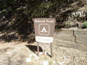
3.23 miles: Sign at start of Dawn Mine trail
3.23 miles: View from shelter of downtown LA and ocean beyond
3.23 miles: View from shelter of Verdugo Mountains
3.23 miles: View towards ocean
3.39 miles: Sign at Horseshoe curve
4.13 miles: Sign at half-way point
4.61 miles: Granite gate - last remaining overhead electric cable support
4.64 miles: Sign describing Granite Gate (sorry but the Sun position didn’t allow for a good photo without shadows)
5.58 miles: Site of Alpine Tavern
5.58 miles: Sign for Mount Lowe Campground/Alpine Tavern site
5.58 miles: Looking back from turn off to Mount Lowe campground
Entering Mount Lowe campground
Mount Lowe Campground: Foundations of Alpine Tavern
Sign at Mount Lowe campground
Mount Lowe Campground
Signs at Mount Lowe campground
Wildflowers at junction to Mount Lowe Campground
5.76 miles: Bear right to Inspiration Point (not on to single track)
5.77 miles: Sign for Idlehour Trail
5.77 miles: Sign for Sam Merrill Trail down to Echo Mountain (technical of ridden)
5.82 miles: Mount Wilson and Mount Disappointment on left
6.0 miles: Sighting tubes at Inspiration Point
View from Inspiration Point with Catalina Island just visible
View from Inspiration Point looking towards downtown LA and ocean in the distance
Inspiration Point
Sign at Inspiration Point
Wheel set at Inspiration Point
Sighting tubes at Inspiration Point
Castle Canyon Trail from Inspiration Point, leading to Echo Mountain (technical single track ride)
Mount Wilson to the East from Inspiration Point
6.72 miles: View into San Gabriel valley
6.72 miles: View looking towards Henninger Flats
6.92 miles: Water tower at end of the road
6.92 miles: View looking towards Henninger Flats and Santa Anita racetrack
6.92 miles: View out to ocean. Long Beach and oil rigs were visible to the naked eye
6.92 miles: View looking towards Catalina (not visible in the photograph but could be seen with the naked eye)
6.92 miles: Looking towards downtown LA and ocean beyond
6.92 miles: View towards Rose Bowl, seen in upper right of photograph
6.92 miles: View of Verdugo Mountains
6.92 miles: Verdugo Mountains to the right, Griffith park in centre and ocean beyond
6.92 miles: View of Mount Lukens (in upper right)
6.92 miles: View of Verdugo Mountains and 134 freeway
Site Last Modified: Tuesday, March 10, 2009


")
")


")


")


")

")


")


")


")
