The Ride
 This ride starts by entering the South Hills Park from Glendora Avenue just North of the 210 freeway through a small opening in the chain linked fence (0.0 miles) leading onto the South Hills road. Climb the paved road which soon turns into a dirt fire-road. This ride starts by entering the South Hills Park from Glendora Avenue just North of the 210 freeway through a small opening in the chain linked fence (0.0 miles) leading onto the South Hills road. Climb the paved road which soon turns into a dirt fire-road.
At mile 0.41 take the left turn to the Walnut trail, passing to the left of the square water tower. Upon reaching the end of the water tower the path turns into a single track. Although this starts downhill stay in a low gear; you’ll soon need it for the short climb out. Alternatively, if the single track is not ride-able (as was the case last time I visited), stay on the fire road.
 At the next fork in the single track (0.8 miles) go right to rejoin the fire road that we left at the water tower. Go left on the fire road. At the next fork in the single track (0.8 miles) go right to rejoin the fire road that we left at the water tower. Go left on the fire road.
At 1.4 miles you pass a turn off to the right (dead-end service road for the power line). Bear left at 1.6 miles and descend into the residential area. You will come out at what appears to be someone’s private drive – I gingerly passed through here but did not see any signs warning of trespassing or private road. Shortly beyond is a small street to the right. Take this to Big Dalton Wash and turn left at 2.14 miles to follow the drain.
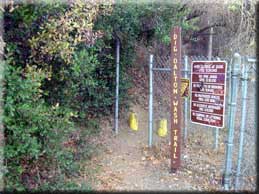
 After crossing a street, at 2.32 miles pass through the fence opening by the sign marking the Big Dalton Wash Trail. This short but fun single track section is arguably the best part of the ride and brings you out at the South Hills city park, where you will find Toyon trail starting on the left at 2.7 miles after passing a childrens play area on the right. After crossing a street, at 2.32 miles pass through the fence opening by the sign marking the Big Dalton Wash Trail. This short but fun single track section is arguably the best part of the ride and brings you out at the South Hills city park, where you will find Toyon trail starting on the left at 2.7 miles after passing a childrens play area on the right.
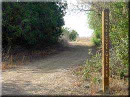
At 2.76 miles the single track forks with a choice between ascending via the Toyon or Wild Iris trail. For this trace I went right to use Wild Iris. Staying with this path (left at 2.81 miles, left at 2.84 miles, left at 2.93 and right at 2.96 miles) will put you out on the fire road we started on. Cross this and turn right, followed at 3.05 miles by a turn to the left onto a paved road. Alternatively you could continue a little further and go left onto Bonnie Cove West - another single track. Both routes bring you down to Bonnie Cove Avenue.
To return to the start go South on Bonnie Cove to Gladstone and turn right. Turn right where Gladstone meets Glendora Ave
|

