The Ride
 After parking at the Santa Fe dam cross Arrow Highway to join the start of the cycle path on the right hand side of the river. This section of the ride passes through a commercial area that transitions into excavations. At 4.2 miles you pass under the 605 freeway, followed by the 10 freeway at 4.7 miles and the 60 freeway at 6.74 miles. Whittier Narrows Dam is now to the right. After parking at the Santa Fe dam cross Arrow Highway to join the start of the cycle path on the right hand side of the river. This section of the ride passes through a commercial area that transitions into excavations. At 4.2 miles you pass under the 605 freeway, followed by the 10 freeway at 4.7 miles and the 60 freeway at 6.74 miles. Whittier Narrows Dam is now to the right.
 At 8.44 miles the path crosses the river. This crossing is normally dry but I’ve seen it flooded (up to the bottom bracket) and to have risen quickly in a few hours. The path zig-zags a little is it goes around a putting green. At 8.44 miles the path crosses the river. This crossing is normally dry but I’ve seen it flooded (up to the bottom bracket) and to have risen quickly in a few hours. The path zig-zags a little is it goes around a putting green.
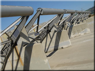
9.3 miles brings a tricky road crossing - you can’t cut straight across due to the median barrier so either turn right and cross at the junction, or take the shorter route as I did by riding against traffic to the other end of the bridge and then crossing the median to reconnect with the cycle path. Back on the path, at 9.54 miles there is a strange cable contraption crossing the river. You will no doubt notice an increasing amount of livestock in properties adjacent to the path, and especially horses.
 14.8 miles brings the 5 freeway, and the 91 freeway is passed under at 19.7 miles. Around 23 miles El Dorado park is on the left, followed by a bridge crossing at 25.6 miles. Pass under the 405 freeway at 26.2 miles - the power plants ahead are a sure sign you are getting close to the end. 14.8 miles brings the 5 freeway, and the 91 freeway is passed under at 19.7 miles. Around 23 miles El Dorado park is on the left, followed by a bridge crossing at 25.6 miles. Pass under the 405 freeway at 26.2 miles - the power plants ahead are a sure sign you are getting close to the end.
After crossing Pacific Coast Highway at 29 miles and Marina Drive at 29.5 miles the end of the path is reached as at merges into the beach. A small restaurant can be found on the left, and exits from the parking lead shortly to the main street of Seal Beach . .
|

