|
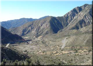
 From the parking area turn left onto highway 39 - there are no turn-offs so just follow the road. At 1.59 miles there is a gate which has recently been locked. 4.89 miles there is another gate and a posted sign indicates the road closed to pedestrians and cycles but plenty of riders bypass the gate, so decide for yourself. The lack of cars and motorbikes makes the ride very pleasant despite the relentless climb. The road also changes somewhat in nature, from being a fast highway to a narrow mountain pass with many tight switch-backs. From the parking area turn left onto highway 39 - there are no turn-offs so just follow the road. At 1.59 miles there is a gate which has recently been locked. 4.89 miles there is another gate and a posted sign indicates the road closed to pedestrians and cycles but plenty of riders bypass the gate, so decide for yourself. The lack of cars and motorbikes makes the ride very pleasant despite the relentless climb. The road also changes somewhat in nature, from being a fast highway to a narrow mountain pass with many tight switch-backs.
At 5.13 miles after a slight dip you will pass the entrance to Coldbrook campground on the left. At approximately 6.7 miles you will round a corner and traverse a section that used to be only one lane wide, before being completely destroyed by heavy rains in the winter of 2004. After seeing the number of months it took to rebuild this section I am surprised the road has not been reopened, but also thankful as it makes for such a perfect cycle ride when there is no traffic.
 A small cabin is on the left at 8.16 miles - there are foundations of others along the way but this is the only serviceable property seen from the road. A small cabin is on the left at 8.16 miles - there are foundations of others along the way but this is the only serviceable property seen from the road.
9.4 miles marks for me the toughest part of the climb - maybe it’s because of all the climbing up until then, or the longer stretch of road without switch-backs, but I always find this part a challenge (having said that, at this section I’ve passed others on high performance bikes, but lacking the joys of a triple crankset!)
At 10.75 miles you will see the sign for the Crystal Lake recreation area. Although this was a very active campsite with its own general store that closed along with the road, although I’ve run into the store keeper a couple of times (a friendly chap who I assume continues to live there). The road to Crystal Lake recreation is at 10.82 miles on the right, at 5084’. That’s about 2 hours from the start and 3257’ of climbing. Most riders I see up here make this junction the turnaround point. Should you chose to take the road on the right, it is a pleasant climb of 1.93 miles to reach the entrance of the campsite, with the general store and picnic area.
Bypassing the diversion to the campsite and continuing on Highway 39 just a little further - to 12.61 miles you will reach a gate and on the day this trace was taken, the end of the snow plowing. The section of road beyond this gate is not as well maintained, although it is occasionally cleared of rocks. It eventually connects with Highway 2, but last time I attempted to complete that section I was stopped by a Forest ranger and told to turn back - the section beyond the gate to highway 2 is closed to all public access. I’ve heard this has been the case since the 1970’s, and various reasons for it’s closure. I think it’s fair to say this is not going to be opening up again anytime soon, if ever.
The return is simply a reverse of the climb. The gradient is just right - you rarely need to pedal but don’t need to ride the brakes either. Note forest service vehicles and a few other visitors do come through the otherwise locked gate so don’t assume there will be no oncoming traffic, especially if inclined to take blind corners wide.
|

