|
 Ascend the road you took into the Millard campground parking, back to the saddle (Sunset Ridge) at 0.6 miles. Continue ahead to the right of the locked gate onto the paved fire-road. Ascend the road you took into the Millard campground parking, back to the saddle (Sunset Ridge) at 0.6 miles. Continue ahead to the right of the locked gate onto the paved fire-road.
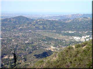
As you climb this road you will be presented with frequent views of the LA basin, including downtown, the rose bowl, surrounding mountains, and possibly the ocean. At 2.7 miles you may see trails to the right on the facing mountain side, and possibly the ruins they lead to at Echo Mountain (White City).
At 2.88 miles Sunset Ridge trail joins on the left. This single track is very popular with downhill riders, so you may want to use it on the return, but note it can be badly rutted and is a bit technical in places. A less technical single track trail to Echo Mountain takes off to the right at 2.93 miles. While not covered in this trace, it is a pleasant diversion that will take you to the ruins.
 Cape of Good Hope is reached at 2.96 miles and ~3480 feet, after which the paved road turns to dirt. The start of the Dawn Mine trail can be found at 3.23 on the left, adjacent to a small shelter. Note, the Dawn Mine trail is interesting to hike but was washed out in a few places last time I visited it, so not a path I would attempt to ride. Cape of Good Hope is reached at 2.96 miles and ~3480 feet, after which the paved road turns to dirt. The start of the Dawn Mine trail can be found at 3.23 on the left, adjacent to a small shelter. Note, the Dawn Mine trail is interesting to hike but was washed out in a few places last time I visited it, so not a path I would attempt to ride.
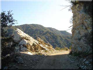
Depending on the state of the road you may have noticed evidence of railway sleepers below the dirt, since this was once a railway bed. At 4.61 miles you will come across the only remaining overhead powerline support for the railway - at a point known as Granite Gate.
5.58 miles brings you to the site of Ye Alpine Tavern. I recommend dismounting and venturing left into Mount Lowe campground to peruse the various signs and artefacts describing the history of this location.
 Bear right at 5.76 miles to take the fire-road to Inspiration Point (not either of the single tracks that also leave this junction). You will see Mount Wilson with all of the communications equipment on the left, and at 6.0 miles/4500’ reach the shelter and signs announcing Inspiration Point. Here you will find more signs describing the history of the location, and sighting tubes pointing out a number of features that are invariably hidden by haze. If you have the energy for a little more riding continue on the fire-road, past Castle Canyon trail on the right, for another 0.9 miles, where the road ends but there are more great views (and usually no one else as this section sees no maintenance and very little use). Bear right at 5.76 miles to take the fire-road to Inspiration Point (not either of the single tracks that also leave this junction). You will see Mount Wilson with all of the communications equipment on the left, and at 6.0 miles/4500’ reach the shelter and signs announcing Inspiration Point. Here you will find more signs describing the history of the location, and sighting tubes pointing out a number of features that are invariably hidden by haze. If you have the energy for a little more riding continue on the fire-road, past Castle Canyon trail on the right, for another 0.9 miles, where the road ends but there are more great views (and usually no one else as this section sees no maintenance and very little use).
Return the way you came, although at 10.93 miles you may elect to take the single track if your skills are up to something a bit technical. There is also an easier single track down to Millard Campground on the right at 13.1 miles, just before the gate. This trail is also a little technical in places, but does not have dangerous exposed sections
|

